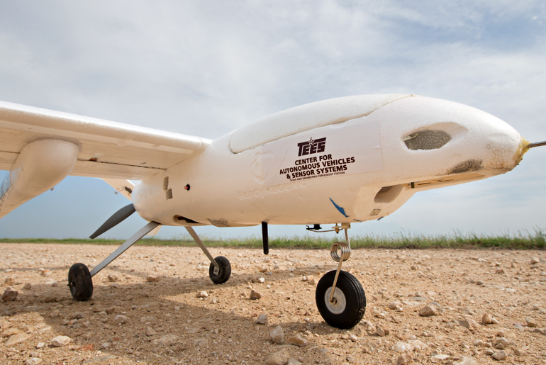
The Texas A&M Engineering Experiment Station (TEES) Center for Autonomous Vehicles and Sensor Systems (CANVASS), Texas A&M AgriLife Research and Extension (AgriLife) and the Center for Geospatial Sciences, Applications and Technology (GEOSAT) at Texas A&M University have joined together to work on a multidisciplinary project titled “Unmanned Aerial Systems (UAS) Remote Sensing at the Texas A&M Farm.”
The project, led by Dr. John Valasek, professor in the Department of Aerospace Engineering and director of CANVASS, Dr. Seth Murray, quantitative geneticist with AgriLife Research, and Dr. Michael Bishop, professor in Geosciences and director of GEOSAT, uses UAS, intelligent systems and state-of-art sensors in precision agriculture research.
UAS is the term used to encompass what are commonly referred to as UAVs or drones. Precision agriculture is defined as the application of technology that seeks to understand a situation (site specific management) and assist in implementing decisions. Thus the value of precision agriculture is timely, actionable information for better management decisions and improved efficiencies, not more data. The use of UAS enables and enhances precision agriculture for continuously monitoring crops, inventorying animal herds and managing irrigation.

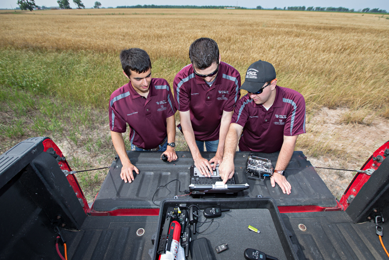
There are three teams involved in flying the UAS for this project, the main one being led by Valasek. The CANVASS team is comprised of four pilots and 24 engineers conducting flight operations using fixed-wing UAS. Typically, one pilot and four engineers are needed for any given mission. Missions are flown on a twice-weekly basis during the crop-growing season, and usually consist of three data collection flights of between 20 to 45 minutes each. To date, 132 flights have been conducted at the farm.
The engineers involved in flight operations include undergraduate and graduate students from the Department of Aerospace Engineering.
“As an undergrad, this is truly a once-in-a-lifetime opportunity,” said Ezekial Bowden, a senior in the aerospace department. “I am able to work in a field that I am passionate about and also gain valuable flight test experience. We continue to learn and understand how different sensors can be integrated into new vehicles in order to achieve the best results possible. It’s amazing to be able to gain hands-on experience with aviation each time we conduct a data collection flight.”
The Federal Aviation Administration (FAA) approved a Certificate of Authorization (COA) that grants Texas A&M researchers permission to fly UAS over the 3,200 acre Texas A&M Brazos Bottoms Farm. Located near College Station, Texas, the farm supports an array of projects for agricultural scientists. The UAS project leverages existing research and extension activities that will benefit from UAS collected data.
The goal of the project is two-fold: to investigate and develop new technologies that will take precision agriculture to the next level; and enable breeders to accelerate crop improvements by using UAS for high-throughput phenotyping. Utilizing an airborne hyperspectral imaging sensor, multispectral imaging sensors, a thermal infrared camera, a visible imaging camera and a light detection and ranging (LiDAR) system, the researchers collect systematic surface imagery and sensor data over the farm.
Agricultural field scientists work closely with aerospace and electrical engineers and remote-sensing and geographic information-processing scientists to aid in making timely and informed decisions regarding crop yield prediction, weed detection, irrigation management and high throughput phenotyping.
“The value precision agriculture brings is not more data, but actionable information,” Valasek told attendees at the National Academies’ Government-University-Industry Research Roundtable meeting on Unmanned Aircraft Systems: Use & Regulation. “Information to farmers must be timely because they need to act quickly. Crop blight and insect infestations, for example, require a same-day response. In the short term, UAS can contribute to precision agriculture by helping with research on better methods, better processes — in particular, automated data processing to provide actionable data faster — and better vehicles.
“In the long term, the commercial aspects — crop dusting and spraying, irrigation and handling risk management — will become increasingly important.”
The main objective for Valasek and CANVASS researchers Dr. Gregory Huff and Dr. Jean-Francois Chamberland, professors in the Department of Electrical and Computer Engineering at Texas A&M, is to research new computational intelligence algorithms, long range communication and ground control techniques for autonomous UAS, in addition to new data processing techniques.
Valasek has prescribed three goals for UAS use in precision agriculture moving forward. The first is to leverage existing UAS technology and turn it into timely, actionable information to enable new science. Precision agriculture currently uses either ground-based vehicles or satellite imagery. The ground vehicles lack the height advantage of UAS, and satellite coverage is usually several days apart and often not at the resolution needed for the science of precision agriculture.
The second goal is to develop Payload Directed Flight techniques, in which the sensor communicates directly with the autopilot and tells it when the UAS needs to be flown differently in order to collect high quality data, or to collect it more efficiently. A new airborne system that CANVASS is developing will combine a high power LiDAR sensor with a hyperspectral sensor to generate 3-D images of crops that are displayed to the user with their visible and non-visible light signatures, such as infrared. These techniques promise to transform precision agriculture and enable new significant science to be conducted.
Finally, because there is a long history of manned aircraft in precision agriculture there is a need to address safety issues and competition concerns by developing UAS operational procedures and policies. Right now there is uncertainty about how UAS will operate with manned aircraft, but it is clear that in the future both types of aircraft will be needed at certain times, and sometimes together. This project is working with the FAA to develop a good database and establish trust in these systems.
Each agency/institution is essential in successfully completing this project and by producing valuable intellectual property and preliminary data that will aid in procuring additional research funding from governmental institutions and private industry. The project started in June 2015 and will continue until December 2016.
Photo: Aerospace engineering students Damon Printz, Cameron Rogers and Ezekial Bowden operating the ground control station
